This section of the website is about the tidal stretch of the river valley between Newton Abbot quay and Teignmouth, and the adjoining settlements.
 Looking down the Teign estuary from the river beach at Luxton’s Steps, which is backed by an attractive sandstone cliff. (January 2012)
The appearance of the estuary changes markedly depending on the state of the tide – from full of water and effectively a branch of the sea at high tide (as in the photo above), to extensive mud flats with a surprisingly small (given the width of the estuary) river winding through them at low tide. As noted in the Overview, the estuary is disproportionately large for the size of the river flowing through it because it is a drowned valley (a ‘ria’ to geographers) caused by a relative rise in sea level following the last Ice Age, around 10,000 years ago.
The villages along the estuary and within the river valley are Bishopsteignton on the north side, and Ringmore/ Shaldon, Combeinteignhead and Netherton on the south side. (Kingsteignton could also be considered as an estuary settlement, as its origins were probably as a small port on a tidal inlet linked to the upper end of the estuary. However, within this website it is convenient to consider Kingsteignton separately and to link it with the history of the local ball clay industry and the Stover Canal, so it is not discussed further on this page.)
 The A380 road bridge over the river at the head of the estuary (January 2012)
There also used to be a small settlement at Hackney, where the Hackney Cut joined the estuary – the remains of some cottages are still there at Hackney Quay close to the Passage House Inn. Allegedly there has been a hostelry of sorts on this site since Roman times. It was the site of a tidal ford and travellers would arrive and wait to cross the river at low tide. The hostelry was named after the ‘passage way’ across the river, and later became the ‘Passage House’.
 Remains of lightermens’ cottages at Hackney, next to the A380 bridge (January 2012)
Nowadays the seasonal flood meadows and reedbeds at the head of the estuary are overshadowed by the A380 road bridge, but the marshy area does provides a valuable landscape break between the built up areas of Kingsteignton and Newton Abbot, and there are open views from there down the estuary to Teignmouth and Shaldon.
 The Old Channel of the river at Hackney, just before it merges with the now larger Newton Channel. When the photo was taken a group of Plymouth University students were here on a field trip to examine the quality of the river and its environment. (January 2012)
Bishopsteignton is set on the north side of the Teign valley, with the village centre on higher ground about 1km from the river. The middle syllable is pronounced as ‘tane’ rather than ‘teen’, as in the River Teign. This has led local historians to claim that the village’s name is not derived from the river just below it, but instead from the Celtic word for river (‘tain’), and the Anglo-Saxon word ‘ton’, an enclosure.
 Fore Street, Bishopsteignton (February 2011), showing two examples of John Nash-designed or influenced properties: the frontage of the ‘Ring o’Bells’ pub and Cross House, on the left with the green balcony. Nash may have lived at Cross House for a short time.
Prior to the Norman invasion the area was known as Taintona, and historians now think that the Romans used the Teign just upstream from the modern Bishopsteignton for the production of salt, which would have been transported via a trackway over the Haldon ridge to a market at Exminster. This could be considered speculative, since evidence of Roman influence west of the Exe is limited. R.R. Selman in his Aspects of Devon History maps a scattering of archaeological finds of Romanised material particularly around Plymouth and Totnes, but concludes that ‘beyond Exeter the romanisation of the civil population was only superficial, if not entirely lacking, and Iron Age farming settlements continued almost unaffected’. But it also seems unlikely that the Romans ignored the South West peninsula beyond Exeter during the lengthy period of their occupation, especially as they would have been aware of the valuable mineral deposits further west, particularly tin. And evidence for an organised Roman presence has started to come to light – in the early 1970s traces of an auxiliary fort at Okehampton were discovered by aerial photography and, much more recently, in August 2011, it was reported that metal detectorists had discovered nearly a hundred Roman coins in a series of fields forty miles west of Exeter. On this (as yet unidentified) site an Exeter University archaeologist subsequently found geophysical evidence of a huge settlement including roundhouses, quarry pits and track ways, together with two burials that seem to be located along the side of the settlement’s main road, which should provide information about the people that lived there.
Several hundred years after the end of the Roman occupation, one of the first recorded events was the burning of the village by Danish raiders in 1001 AD, following which the signing of a peace treaty between the English and the Danes was supposed to have taken place in Peace Park, close to the site of Old Walls. But at this time Danish raiding parties were apparently intent only on plunder, rather than settling here, so a peace treaty with one group of locals doesn’t appear to be very meaningful or likely, and there may be no historical basis for this.
In 1042, Edward the Confessor split Taintona into two. He retained one part for the Crown, now known as Kingsteignton, and gave the other to Bishop Leofric of Exeter, which became known as Bishop’s Tainton. The remains of the Summer Palace originally built for the Bishops of Exeter during the 13th century, are located a short distance north east of the village.
The neglected remains of the Bishop’s Palace, now in a working farmyard (February 2011)
Bishop John de Grandisson (1327-69) who was responsible for rebuilding Exeter Cathedral, also had the Summer Palace rebuilt, and it was used as a refuge during the Black Plague, which killed large numbers of people living in cramped conditions in the towns. (One of Bishopteignton’s pubs is named after him – the building is thought to be Elizabethan in origin.)
 The Bishop John de Grandisson pub (January 2012)
The Bishop’s Palace was disbanded on the orders of King Edward VI in 1549. Thereafter, it was used as a source of building material, hence its now sorry state – several 19th century houses in the village include stones ‘recycled’ from the palace.
John Nash, the architect of Buckingham Palace and who is credited with designing much of the layout of London during the Regency period, worked in South Devon in the early stages of his career, notably on Luscombe Castle in Dawlish. It is claimed that he designed, or that his work was an influence on, a number of houses in Bishopsteignton. .
 Cross Gate House, just across the road from the ‘Ring o’Bells’. (January 2012)
 Rose Cottage – Nash’s alteration to this house on the corner of Fore Street and Clanage Street is reputed to be his first piece of paid work. (January 2012)
The village also has some more recent dwellings of interest: Church Houses (also known as the Almshouses) were built on Radway Hill in 1861. These were tenements to be let to “poor men and women of good character”, and 150 years later they still they retain their original use.
 Church Houses, Radway Hill, Bishopsteignton (January 2012)
Combeinteignhead is an attractive small village situated about one kilometre inland from the estuary, built around an ancient church with a 12th century font . The village’s name would seem to imply the head of a valley close to the source of the Teign, but clearly this doesn’t fit with its position. As with Bishopsteignton, local historians report that, rather than the river Teign, the name of the village is derived from the district within which the village was situated at the time of the Domesday Book: it contained thirteen manors which totalled ten hides and the whole area was known as the ‘Ten Hide’. (A ‘hide’ was thought originally to refer to an amount of land sufficient to support a single household, and later became a unit used in assessing land for liability to tax, but it never had a fixed relationship to acreage). ‘Ten Hide’ was later corrupted to ‘Teignhead’ through the influence of the river name. (The name of the nearby village of Stokeinteignhead has a similar derivation.)
 A corner of Combeinteignhead (June 2011) The modern village has two historic pubs: the Wild Goose Inn, originally called the Country House Inn, a 17th century tavern in the village centre, and the Coombe Cellars Inn, right on the estuary.
 The Coombe Cellars Inn. Fishing and smugging used to take place from here, and it is the setting for the novel Kitty Alone by the Victorian writer Sabine Baring-Gould
Before modern drainage and sea defences were possible, Bishopsteignton and Ringmore, situated away from tides and floods, were more amenable places to live than right down on the coast.
 Bishopsteignton seen from the path to Luxton’s Steps (on the estuary) (January 2012)
Going back in time ….Two thousand years ago the British or Celtic inhabitants would have tilled their tiny fields on the well drained hillsides, and conducted fishing and hunting along the Teign. They kept sheep, pigs and bees, and grew onions and beans. Their staple diet consisted of fish and molluscs with occasional meat, coarse bread and gruel, beans and wild fruits, including some apples, pears and plums. They would have worked from dawn to dusk, and lived in small cob built houses, often shared with their animals. Salt was produced from saltpans alongside the tidal stretches of the river. Heat from the sun was usually insufficient to evaporate off all the water from the brine, so it was heated in containers called salterns over wood fires. It was impossible to feed all animals throughout the winter, so many were slaughtered in the autumn and salt used to preserve the meat for later consumption.
After the Dart the Teign has the second largest catchment area on Dartmoor, where the annual rainfall can top 90 inches (2200mm). Although one of the river’s two headstreams, the South Teign, is dammed (to feed Fernworthy Reservoir), and therefore heavy rain has less effect on river flows than would otherwise be the case, flood risk is still an issue for people living close to the river along the estuary. A Government funded project to reduce the risk of tidal flooding in Shaldon and Ringmore, was completed in May 2011. It cost over £8m and involved raising the height of 940 metres of existing foreshore walls, building 470 metres of new walls, installing 10 floodgates and 25 flood windows and doors together with steps and ramps at various locations.
 A new flood defence wall at Ringmore (May 2011). The flap is designed to let out water trapped behind the wall, but to prevent river water getting in.
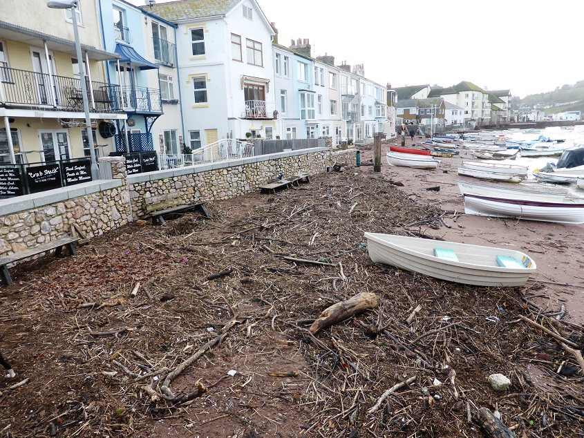
Debris washed up against the flood defence wall at Teignmouth back beach (January 2104). During January 2014 there was a succession of storms which produced a combination of strong river flows and low atmospheric pressure, causing very high water levels at high tide.
There are several contributory factors to the increased risk of flooding, including gradual silting up of the estuary due to soil erosion exacerbated by damaging agricultural practices, rising sea levels, and more frequent extreme weather events – the last two in turn caused by man-made climate change, the evidence for which is now undeniable. The Transition movement, started in Totnes in 2006, consists of local groups of people concerned about the effects of climate change and our continued complete dependence on increasingly scarce fossil fuels. These groups have realised that there is no point in waiting for governments or big businesses to take action, and they are getting together to plan and implement step-by-step changes towards a more genuinely sustainable future. There is an active Transition group of people from communities around the Teign estuary – see their website at http://teigntransition.org.uk/
The original settlement at Ringmore, in the fertile valley at the head of which is New Barn Farm, where the inhabitants were hidden away from raiders coming from the sea.
 Fields next to New Barn Farm (June 2011)
Up to a hundred years ago Ringmore had many working farms, extensive apple and other orchards, including cider apples, watercress beds, and withy beds used for making lobster pots. There were also shipbuilding and repair yards on the waterfront.
 Site of former shipbuilding yard next to The Strand at Ringmore (May 2011). Originally the deep water channel to the sea was on the Shaldon/ Ringmore side of the estuary.
 The beach next to Ringmore Towers (May 2011). Ringmore Towers is a flamboyant red sandstone pile with towers and battlements, jutting out into the estuary. It was constructed by a builder called Collins sometime around 1890; he lived there until his death around 1925. It is now divided into apartments.
‘Ringmore’ is derived from the Celtic ‘Bryn Maur’ meaning great hill. The village has a church dedicated to the Celtish saint Nicholas of Myra, who probably originally came from Ireland.
 The church of St Nicholas, Ringmore (May 2011). This little church is thought to be of 13th century origin, and there was probably an even earlier wooden Saxon church on the same site.
 A gravestone in Ringmore church, one of many of local seafaring men who died in faraway places – in this case Thomas Eales, who died in 1872 in Pernambuco, in the north east of Brazil.
Shaldon was built later, initially on land reclaimed from the river, using river silt and sand washed in from the seaward side by strong winds and waves.

The Teignmouth – Shaldon ferry leaving Shaldon beach (June 2011)
When crossing the river over the Shaldon Bridge from Teignmouth the first building on the left in Shaldon is St Peter’s church, which manages to look much bigger than it actually is, due to the buttresses and the horizontally banded masonry frame around the west window.
 St Peter’s church, Shaldon (January 2013)
In 1890 the newly appointed vicar thought that Shaldon needed its own church, rather than continue to share the one at Ringmore. He purchased a large riverside house and part of its garden for the site, and appointed Edmund Sedding as architect; Sedding he was a member of a highly regarded family of church architects. Sedding’s original idea was to incorporate the lower parts of the north and south walls of the existing house into the church, but the church was much longer than the house and this was abandoned. He also planned a tower on the river side of the church, which would undoubtedly have improved the appearance of the building, but foundations for such a structure in river silt would have been problematic, and it was never built. Otherwise no expense was spared – a variety of materials were used to create decorative designs, including marble, Polyphant (a greenish stone from Cornwall), Portland Stone, and Ham Hill limestone, and there is much elaborate carving.
 The interior of St Peter’s church, with Christmas decorations. (January 2013) The screen has tracery in Polyphant and marble with wrought ironwork; the statues on the top are of four Saints and the Virgin Mary.
 A collection box in St Peter’s church, with elaborate wrought iron hinges and ornamental lettering, (January 2013)
In Shaldon the retaining wall of Riverside was constructed about 1800, to prevent the river returning to what used to be its beaches.
 Recently enhanced flood defence wall at Shaldon beach (July 2012)
Shaldon Regatta is one of the oldest in existence having started in at least 1817. It is known that a rowing race was run between Teignmouth & Shaldon in 1773, as this is mentioned in a letter to the diarist Fanny Burney – this may have been a precursor of the regatta. The village also holds an annual Water Carnival – here is one of the water-borne entries in the carnival parade – something to do with Hiawatha?

The ferry between Teignmouth and Shaldon is one of the longest established in the country. An impression of gun ports was originally painted on the side of the ferry boat in 1905 to mark the centenary of the Battle of Trafalgar, and the tradition has continued.
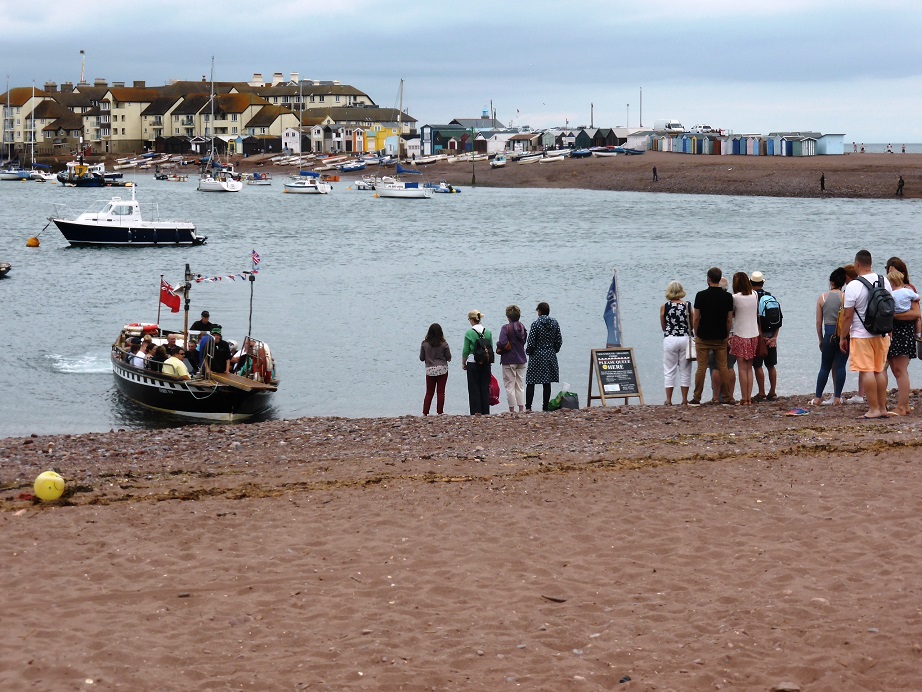 Waiting for the ferry at Shaldon beach (July 2016)
The Ness headland, where the Teign meets the sea, consists of rock called breccia, i.e. composed of broken blocks or fragments cemented together by a fine-grained mass of material. The sandstone strata that now form the Ness were originally laid down in the Permian period, between about 300 and 250 million years ago, when all the Earth’s major land masses were collected into a single supercontinent known as Pangaea. The land that has ended up here was at the time much nearer the equator in desert conditions. The rock is fairly easily eroded, because hard beds of breccia alternate with softer beds of fine sandstone grains.
 Fallen chunks of rock below The Ness headland (January 2013)
 A warning sign on the cliff face at The Ness (January 2013)
Shaldon has many attractive Georgian buildings, dating from the early 19th century.
 Georgian houses on Fore Street, Shaldon (July 2012)
 Houses in Riverside, Shaldon (January 2013)
In the 1890s Shaldon was described as ‘a village where sea-captains of all shapes and colours come to their last moorings, as anyone may see by the white flagstaffs and the figureheads staring in ghastly stiffness from the rockeries and alcoves in the trim little gardens’.
 Presumably there are now more bankers and solicitors than retired sea captains to be seen around the village, but there are still some traditionally whiskered fishermen, as seen in this picture of a group chatting on the beach. (July 2012) In 2013, during an episode of the TV programme Countryfile, two of these splendid fellows were interviewed about the declining numbers of fish in the estuary. To demonstrate the problem they rowed out a seine net from this spot, intending to catch sea trout – on that occasion they caught just one salmon, which was returned to the river, and no trout at all.
Earlier History of the Estuary
It is thought that Saxon raids along the south coast began in the third century AD. Stories of raids elsewhere and of the terrible havoc caused, would have been brought to Teign valley people by travelling tradesmen. Look outs would have been posted, cattle and sheep kept close to the stockade, and children told to come at first call. When and where the risk of raids was considered greatest, the local inhabitants withdrew inland to fortified earthworks erected for protection. There are still traces of such an earthwork at Castle Dyke on the Haldon ridge above Dawlish.
Raids and associated settlement by people from across the North Sea, increased gradually over the next several hundred years. Twelfth century chroniclers Wace and Layamon record a skirmish on banks of the Teign in (maybe) the sixth century. Cador, Earl of Cornwall, and his churls pursued Childor, the Saxon Kaiser, and his troops as they fled to their ships moored in the Teign, killing Childor himself and many others. Perhaps the affray took place at Walsgrove or Wolfsgrove, which has survived as the name of a house to the west of Bishopsteignton, and which is derived from Saxon ‘wael’, which means ‘place of slaughter’. But by the mid-seventh century there is evidence that the lower Exe valley was occupied by Saxons, and Exeter had a mixed population of Celts and Saxons. By 682 AD both banks of the Teign estuary were in Saxon hands.
 ‘Wolfsgrove’, on a minor road from Bishopsteignton to Kingsteignton
The outcome of the battle of Haldon Hill in 927 AD between the Celts and the Saxons confirmed Devon as under Saxon control, while Cornwall remained Celtic. After that King Athelstan founded a monastery at Taintona, at the site now known as Old Walls at Ashill, just north of Bishopsteignton. It later became a Benedictine community, but fell out of use in the early 13th century. In 1042 Edward the Confessor gave West Teignmouth and the eastern part of Taintona to his close supporter and friend Bishop Leofric of Crediton, after which the latter became known as Bishop’s Tainton. The king retained the area now known as Kingsteignton.
From the early 1700s the trade in ball clay quarried around Kingsteignton caused an increase in water-borne traffic along the estuary, and from 1795, soon after the Stover Canal was built, a small fleet of barges transported clay from the canal loading points to Teignmouth harbour. (See the webpage on the Stover Canal)
 The information board at Arch Brook, with an illustration of the clay barges (August 2011)
In the nineteenth century work on the estuary was probably more strenuous and at least as dangerous as work at sea. Each barge carried up to 35 tons of clay and when fully loaded there was a risk of sinking both during the voyage down river and in the choppy waters of the harbour. Two lightermen worked each barge, loading from a wharf on the Stover or Hackney canals or at the quay by the railway bridge at Newton Abbot, which is still usable today.
 Newton Abbot quay, looking downstream towards the A380 bridge (September 2009)
On arrival at Teignnouth the lightermen were expected to help with transferring the cargo to the vessel for onward transportation, which was usually moored at one of the buoys in the harbour. Once they had taken the barge back upstream, one round trip was normally considered a days work, but their hours varied depending on the state of the tide. During the nineteenth century propulsion was by a square sail if the wind was favourable, and progress could also be aided by the flow of the river or the tide and, if necessary, by long poles wielded by the lightermen. Then, from around 1900 most barges were towed by a steam tug, hooked up in long strings two abreast.
 Looking across the estuary from Arch Brook towards Bishopsteignton at low tide (May 2009)
Clay barges comprised the bulk of estuary traffic in the 19th century, but there was also river-borne trade in mineral ores, coal, culm for local limekilns, timber, corn, groceries, bark, hides, iron and salt. As well as the barges, a few cargoes were carried to and from the river beaches and jetties at Flow Point, Arch Brook and Coombe Cellars, and to the quays at Newton Abbot, in very small sea going vessels capable of negotiating the shallow channel. Between the World Wars the deep water channel leading to the Stover Canal was dredged regularly, but the conditions of the channel were only understood by local people and lightermen, and no sea-going vessel passed beyond Shaldon Bridge after 1918.
There was also smuggling … measures to try to stop it were intensified during the Napoleonic Wars but it took some time for the new system of Coastguards to become effective, and as late as the 1850s Coombe Cellars was still used to land tobacco from where it was taken over Lower Haldon to Powderham and across the river to Lympestone, which at the time was a notorious haunt of smugglers.
 Shaldon Bridge (January 2013)
The original 1827 bridge was made of wood, 1,632 feet long and with 34 arches. It had a swing section at the Teignmouth end that allowed tall ships to pass. The first bridge was attacked by woodworm and didn’t last long, being rebuilt in stone between 1838 and 1840. This second bridge remained in use until 1893 when it was closed again to be completely refurbished. As small horse drawn vehicles were replaced by much heavier cars, lorries and buses, the bridge needed to be widened and strengthened, and a new concrete and girder structure was completed in 1931 Further widening and strengthening work was undertaken between 1998 and 2002.
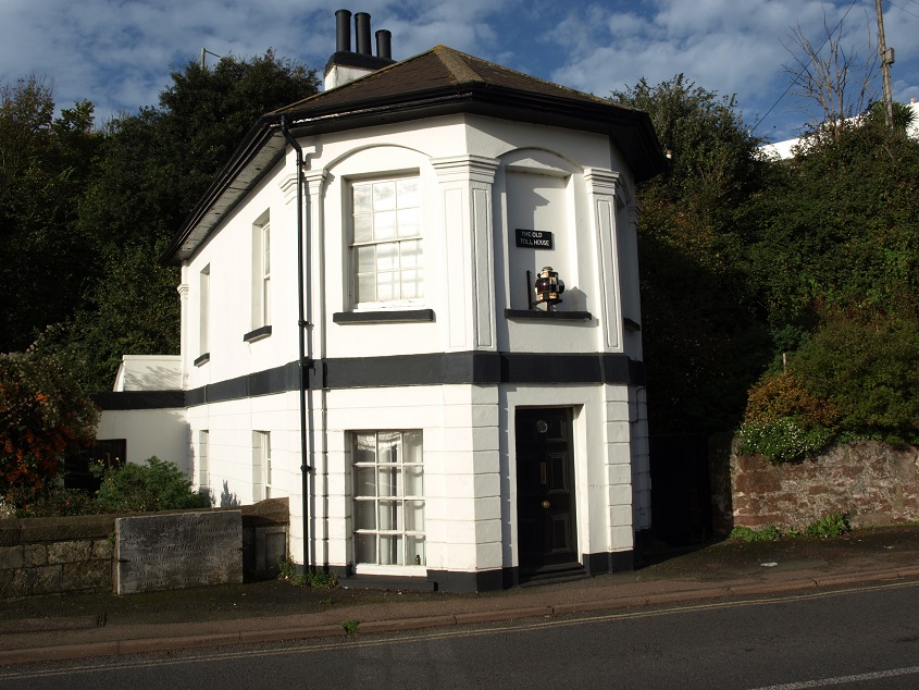
There were toll houses on both ends because it was part of the network of turnpike roads developing at that time. The one at the Teignmouth end is still there (November 2013).
As noted on this plaque, the tolls were abolished in 1948 when the bridge was purchased by the County Council. 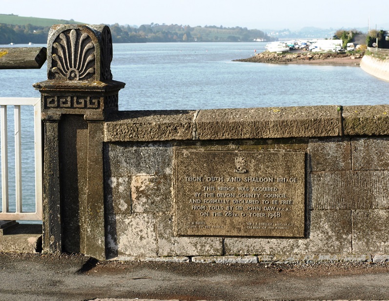
Looking downstream from Shaldon Bridge at high tide. (November 2013)
 The Teign estuary from Knowles Hill, Newton Abbot, looking over the racecourse and the A380 road bridge. (February 2012)
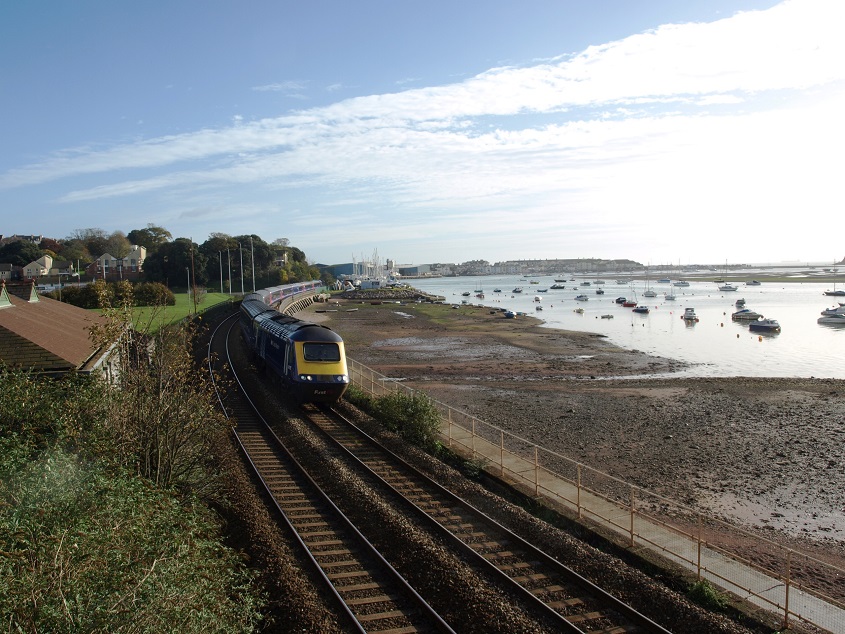
 Looking down the estuary from a position above Kingsteignton. The white building just above the A380 road bridge is the Passage House Inn. The Old and New Channels of the river can be seen to join opposite the Buckland Waste Water Treatment Works. The railway line can be seen snaking along the northern shoreline – here it is just below Shaldon Bridge (November 2013).