This page covers the valleys of the North and South Teign rivers from the source area on Dartmoor downstream to Chagford Bridge, together with the catchment of the Blackaton Brook, a tributary which drains the area between the main river and a watershed line just south of the A30 trunk road.
The two branches of the Teign rise in the boggy upland area of central North Dartmoor, that also provides the source of the Dart and other significant Devon rivers such as the Okemont and the Taw.
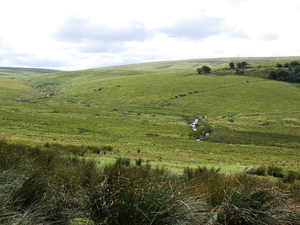
The North river originates north west of Sittaford Tor, passing north of that hill soon after and then flows north east towards Teigncombe and Chagford.
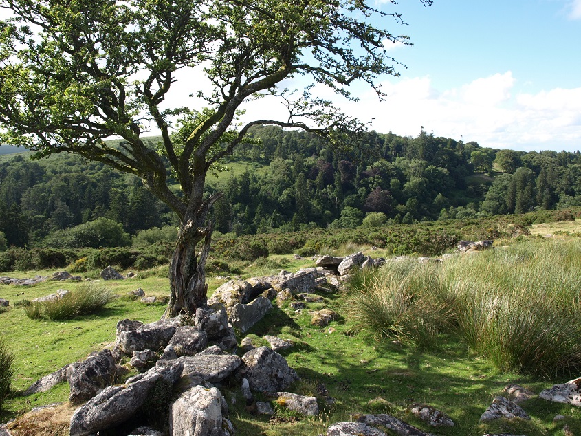
 The North Teign river in the closed-in valley called Great Varracombe. (August 2012) At the point where it disappears between the hills towards the top left of the picture, it is only about half a mile from its source. The remains of Teignhead Farm are seen at top right.
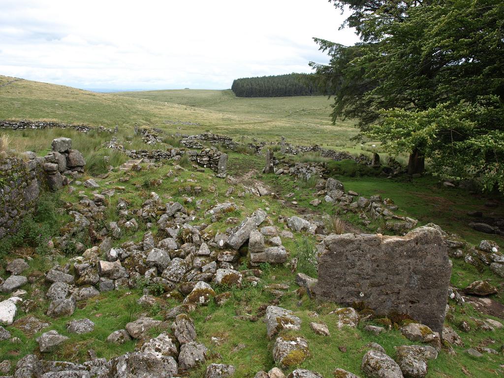 Part of the remains of the Teignhead Farm buildings (August 2012). In the background is the clearly delineated northern end of the Fernworthy Forest plantation. When visiting the ruins of the farm one is bound to think about the enormous effort that must have gone in to construct the buildings and the considerable lengths of field walls in such a remote place. It is not known when the farm was abandoned – in ‘The Rivers of Devon from Source to Sea’ John Lloyd Warden Page reported that it was still occupied – by a Scottish shepherd and his family – when he walked this way in the early 1890s.
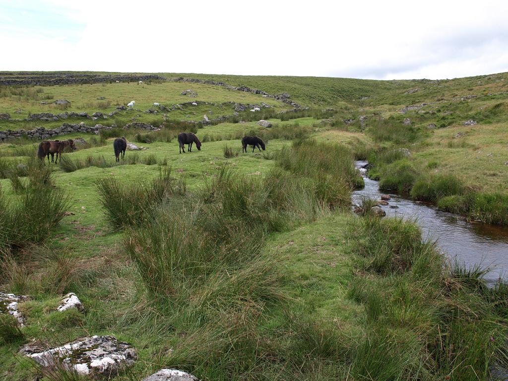 Horses grazing beside Manga Brook, the first tributary to join the North Teign river. (August 2012)
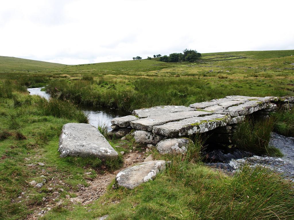 The clapper bridge over the North Teign on the track to Teignhead Farm. (August 2012) This is not as ancient as it looks, dating from the early 1800s, soon after the farm was built. It is thought that the large stones were brought down from Manga Hill on sledges when it lay under snow. It was built wide enough to allow a loaded packhorse to pass over it, and became part of the ‘Teignhead Road’ which was used to transport peat from the moor to Teigncombe and on to Chagford.
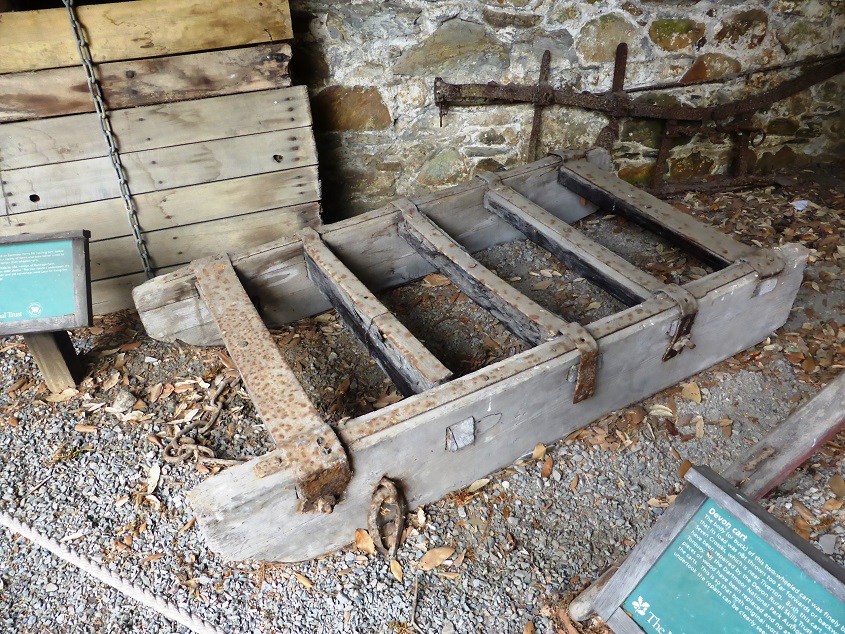 An example of a sledge designed for use on Dartmoor. (August 2013) This one was made in the 1930s by re-using parts from another sledge. It is on display at Parke.
Scorhill Stone Circle is located on the eastern edge of the moor, about 200m north of the Teign. It is not at all prominent in the moorland landscape, but the size and number of its stones are impressive nevertheless. Twenty three stones are still standing and eleven others have fallen, in a circle with a diameter of 27 metres. Experts estimate that there were originally about 70 standing stones, but the monument has clearly been considered as a source of building materials, with several of the remaining stones showing signs of marks left by stone cutters attempting to split them into smaller pieces.
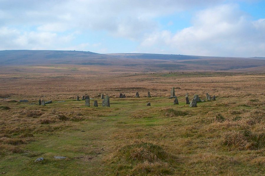 Scorhill Stone Circle. Watern Tor and Wild Tor are on the skyline. © Richard Knights
Round Pound is another interesting feature, about 1km south east of Scorhill, below Kestor Rock on a slope leading down to the North Teign.
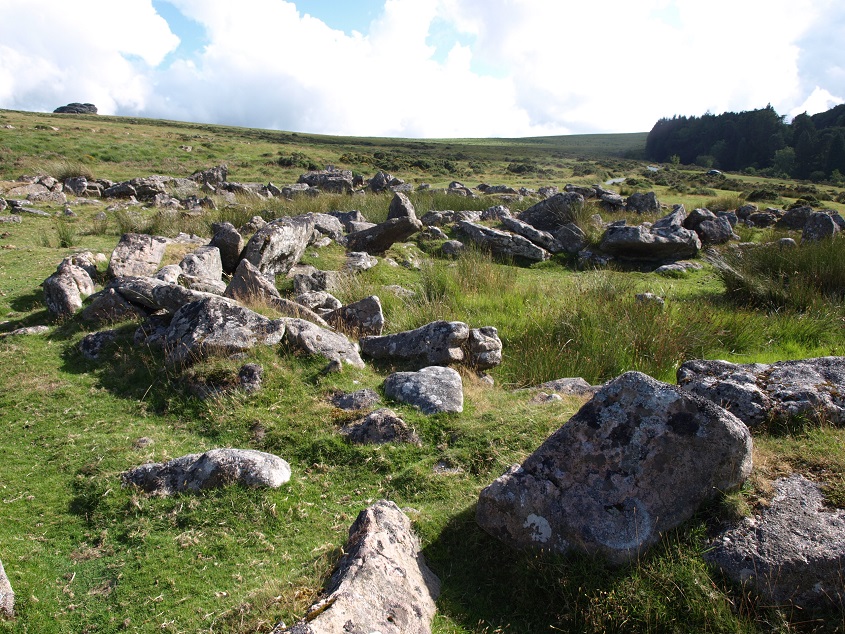 Remains of a large roundhouse within a circular enclosure at Round Pound (August 2013). Kestor Rock is on the horizon; the trees on the right are the edge of the Batworthy enclosure.
There have been two excavations of this site. The first, in the 1950s, concluded that it originated in the Iron Age around 400BC, and that evidence of an iron smelting furnace indicated that a metal worker lived in the largest hut of the settlement. However, a more recent excavation decided that the site was established earlier, in the Bronze Age, and questioned the dating of the metal working finds, positing that they may be from medieval activity. Whatever the final conclusion, and in spite of the remote nature of the location now, it seems probable that this place was inhabited over a very long period of time, although not necessarily continuously.
 Looking towards woods in the North Teign valley from Round Pound (August 2013)
The South branch of the Teign is not so clearly defined. Before the Fernworthy Reservoir was created in 1942 the stream that rises just less than a mile SSE of Sittaford Tor was known as the South Teign, but now this is named as Winney’s Down Brook on the OS map, and the South Teign label is reserved for the river emerging from the Reservoir. In fact Winney’s Down Brook divides soon after its source, one branch joining the juvenile East Dart and other continuing North East towards Fernworthy.
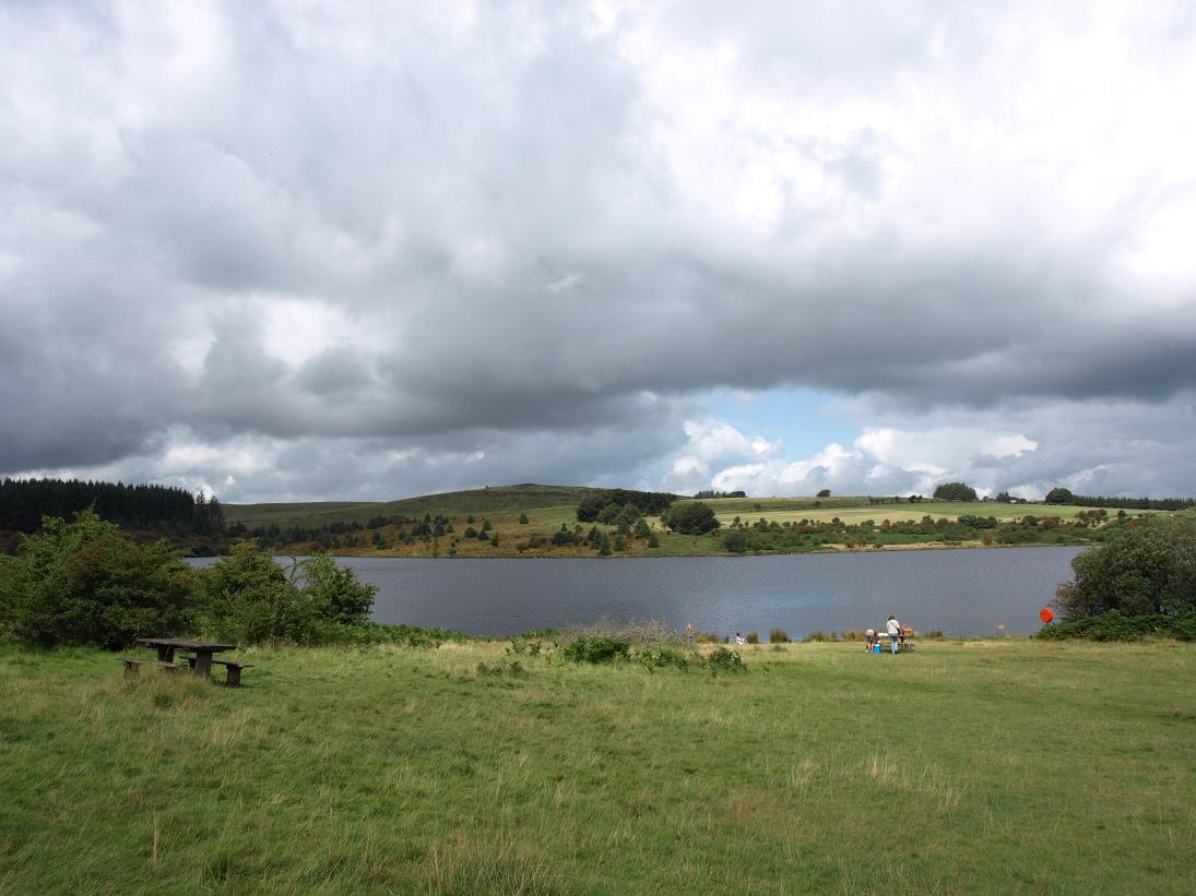 The Fernworthy Reservoir from near the visitor centre (August 2009).
It may seem strange that it was considered worthwhile creating a reservoir fed by such a small stream. In Worth’s Dartmoor, a very detailed account of Dartmoor history and archaeology, the author R Hansford Worth (1868-1950) examined records of a severe (but not exceptional) rainstorm in November 1929 and the resultant flows of various Dartmoor rivers including the South Teign at Fernworthy, the watershed of which was estimated at 2,400 acres – the river flow was calculated at 105 million gallons (about 477 million litres) in 24 hours. The average UK household consumption of water is about 120,000 litres per year, so just one day of heavy rain around Fernworthy could theoretically provide enough water for around 4,000 households for a whole year.
Fernworthy Forest was planted on the land of Fernworthy Farm, which was purchased by the Duchy of Cornwall Estate in 1917. After World War I the newly formed Forestry Commission persuaded the Prince of Wales to permit some of his open moorland to be planted with conifers to replenish British timber resources and provide some local employment, and Fernworthy was the first tract of land to be planted.
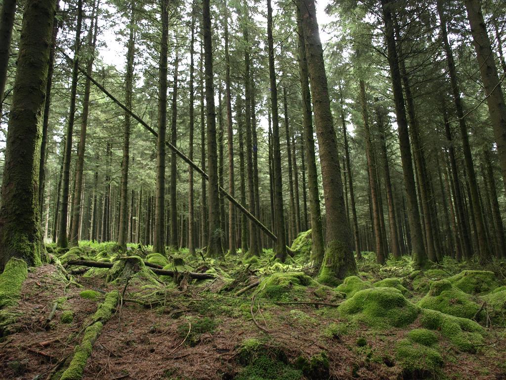 Trees in Fernworthy Forest (August 2012). The moss cover is confirmation of the high levels of rainfall around here.
Occasionally, low water levels in the reservoir reveal the remains of Fernworthy Farm and a small granite clapper bridge which once crossed the South Teign River.
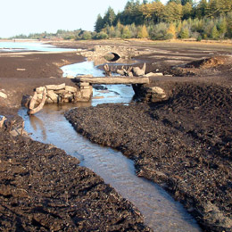
Bridges over the South Teign revealed due to low water level in the Fernworthy Reservoir.
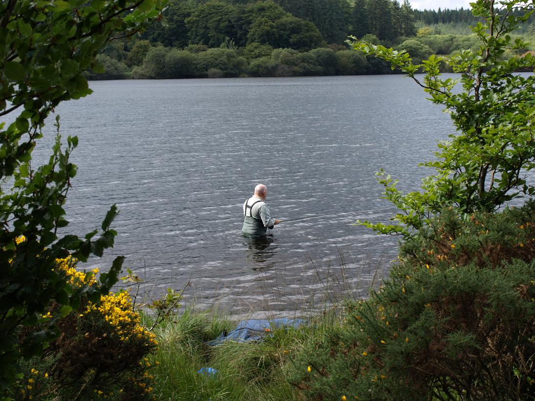 Fishing in Fernworthy Reservoir (August 2009)
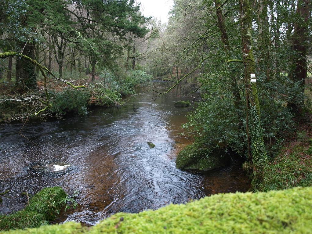
The South Teign emerges through the dam at the northeastern end of the Fernworthy Reservoir and flows northwards for a couple of miles to its confluence with the North river near Leigh Bridge.
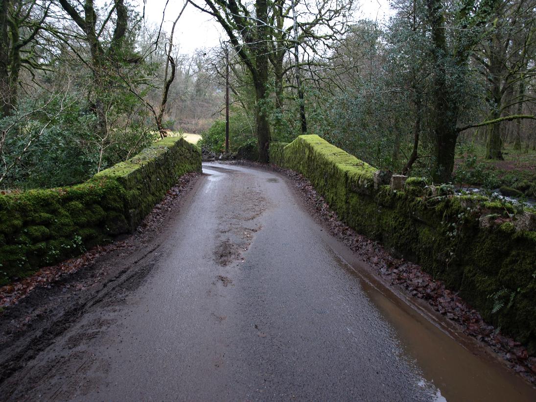
 Yeo Bridge (August 2013). This is the only road crossing of the South Teign before Leigh Bridge.
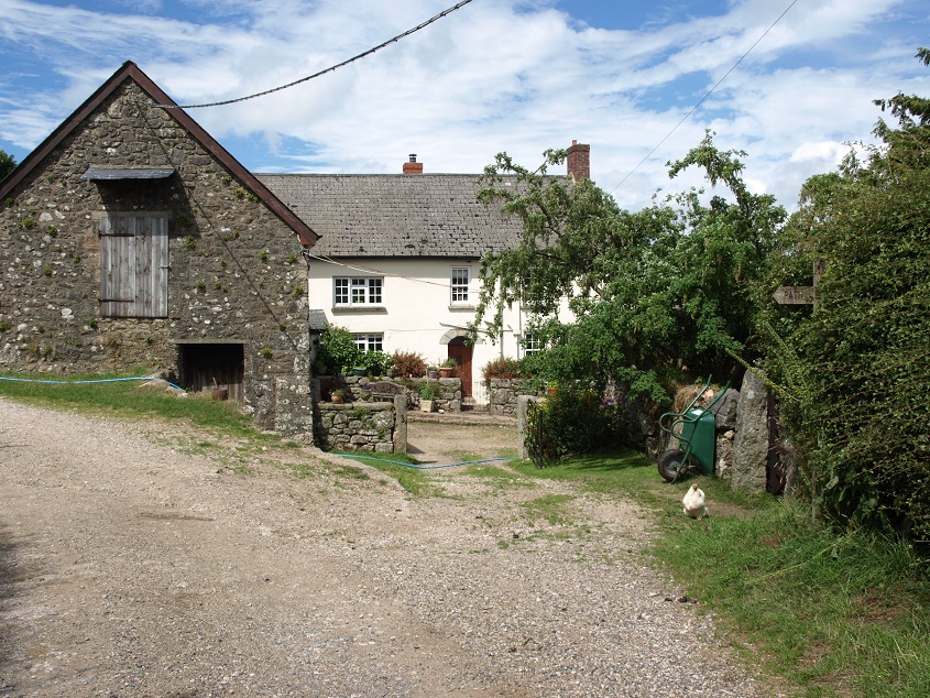
 Yeo Farm (August 2013). A farmstead dating back at least to the early 14th century, with a substantial group of buildings which remain largely unaltered since the 19th century. The Perryman family lived here for over 400 years until it was sold in 1987. Its history is well documented – in the early 1980s members of the family deposited a large collection of documentation relating to the farm with the Devon Record Office.
The hamlet of Thorn is about half a mile east of Yeo Farm on the road to Chagford.
 Thorn Cottage (August 2013). This attractive looking cottage was built in the late 19th century; the next door farm buildings are far more ancient.
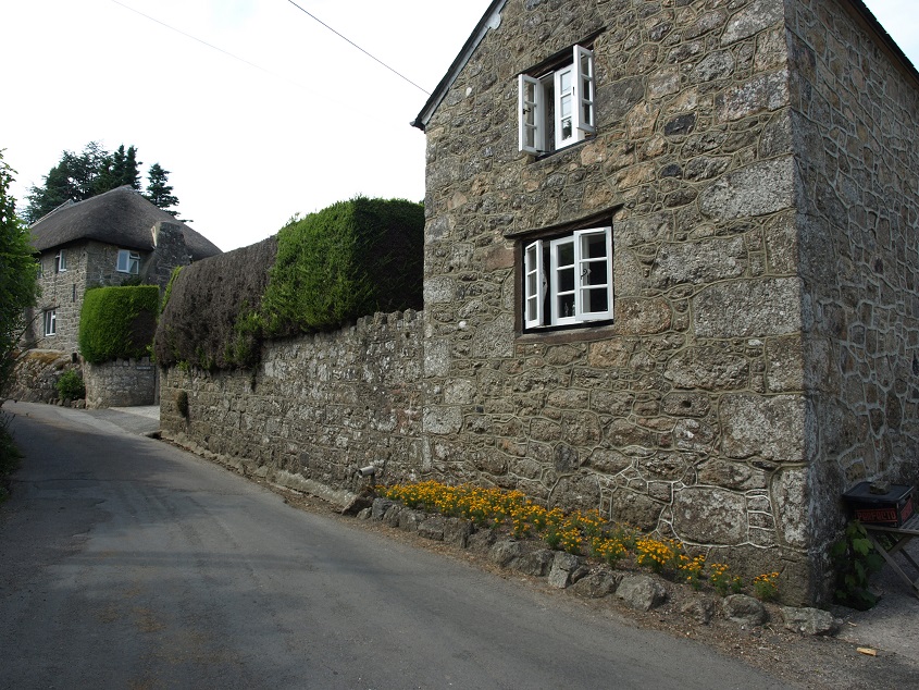
Which brings us to Chagford, the largest settlement in the area covered by this page, with a population of about 1,500. It is set on the eastern fringes of Dartmoor, on a hill above the River Teign. Records show that it held a market charter before 1120, and later flourished after being chosen by Edward I in 1305 as one of the three Dartmoor stannary towns through which all exports of tin collected by the moorland miners had to pass for assay and stamping. This meant that the miners bought their provisions in Chagford and patronised the local hostelries.
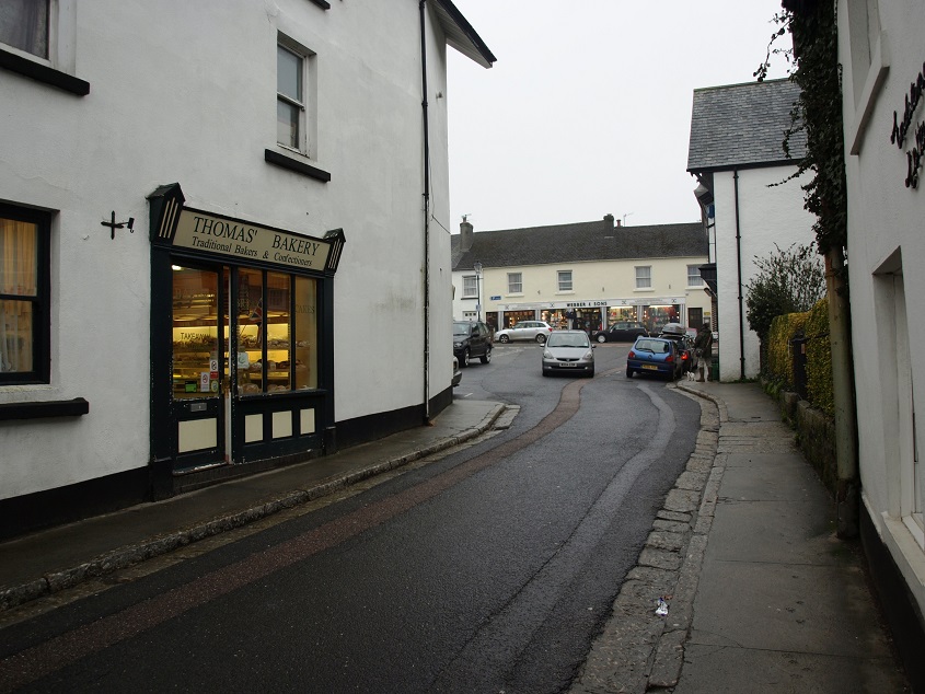
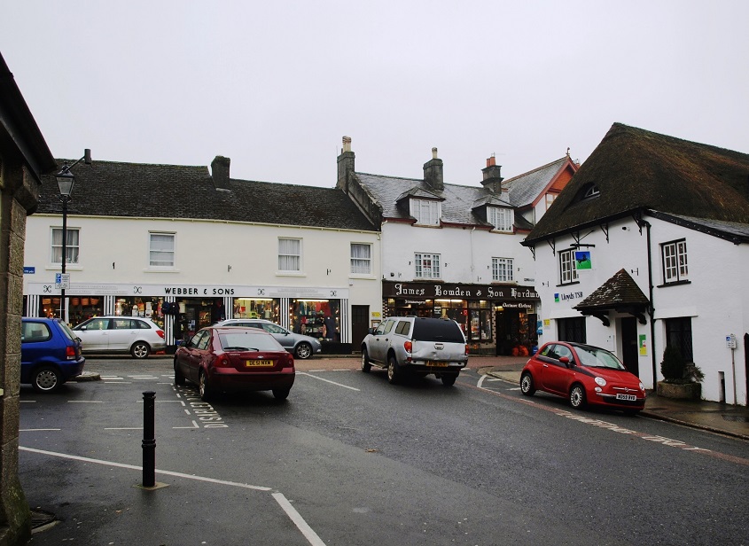 The junction of North Street and Mill Street in the centre of Chagford (March 2013). Between them the two shops ahead in Mill Street – Webber and Sons and James Bowden and Son – seem to sell just about everything you could think of.
By the end of the 16th century the tin works were almost exhausted, but by then Chagford had developed a good business spinning wool from local sheep, which was then weaved into cloth in various East Devon towns. Towards the end of the 19th century, as the wool industry declined, it was still a local market centre, with four cattle and sheep fairs each year, and it re-invented itself as a tourist destination, initially for well-to-do ramblers, horseriders & fishermen.
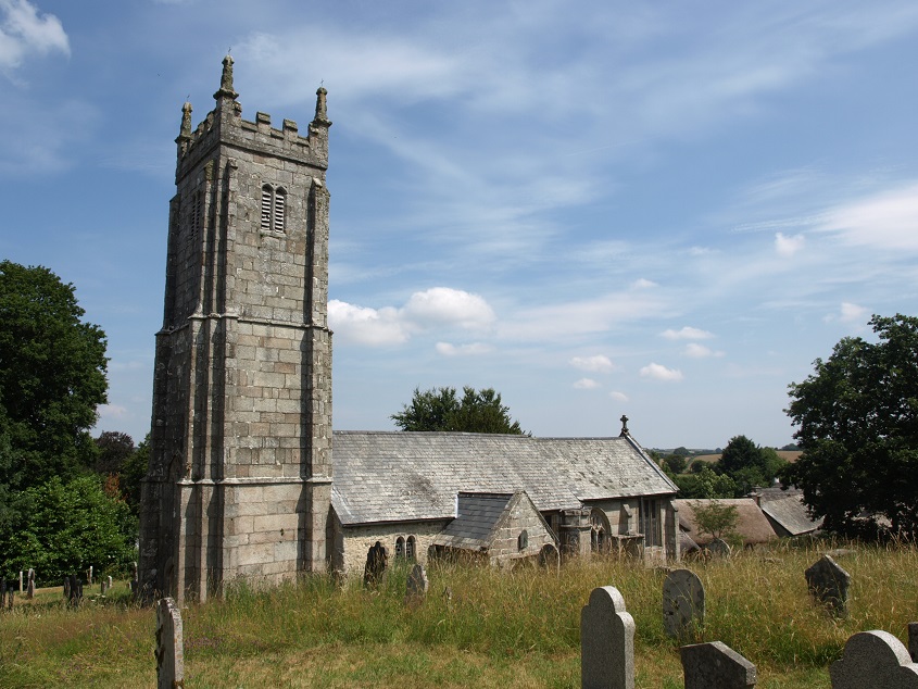
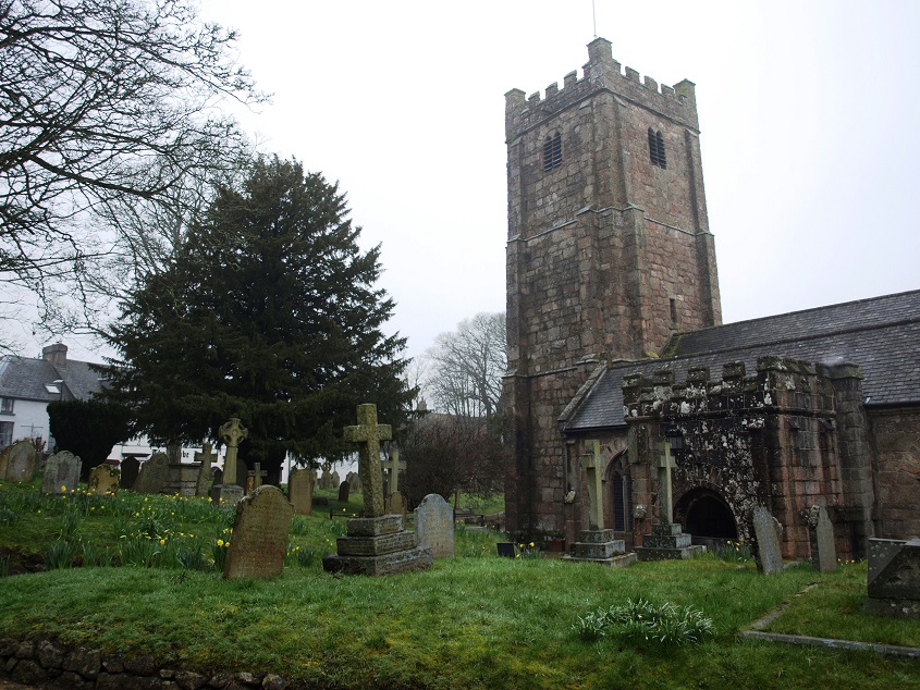 St Michael’s church (March 2013) contains an Elizabethan monument to Sir John Whiddon, (died 1575).
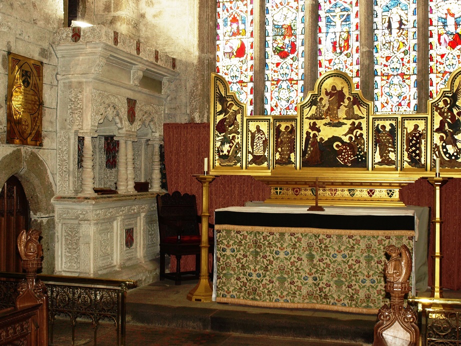 The Whiddon memorial in Chagford church, seen to the left of the altar. (August 2013)
He bought the manor of Chagford and had a manor house and deer park with walls up to ten feet high constructed at what became Whiddon Park, at the western end of the Teign gorge, on the opposite side from where Castle Drogo was built over three hundred years later. Today the park is managed by the National Trust as a Site of Special Scientific Interest.
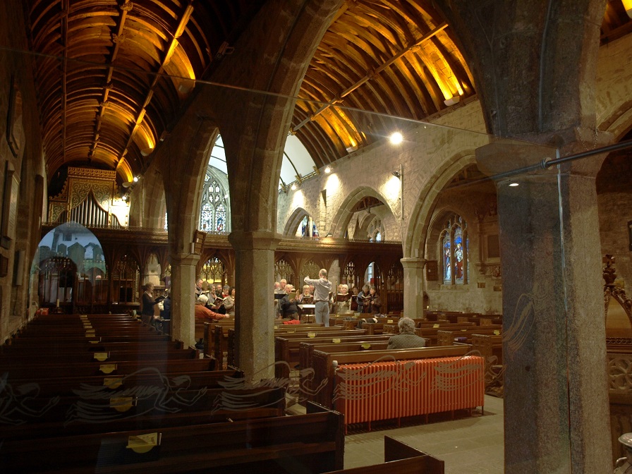 A choir rehearsing in St Michael’s church. (March 2013)
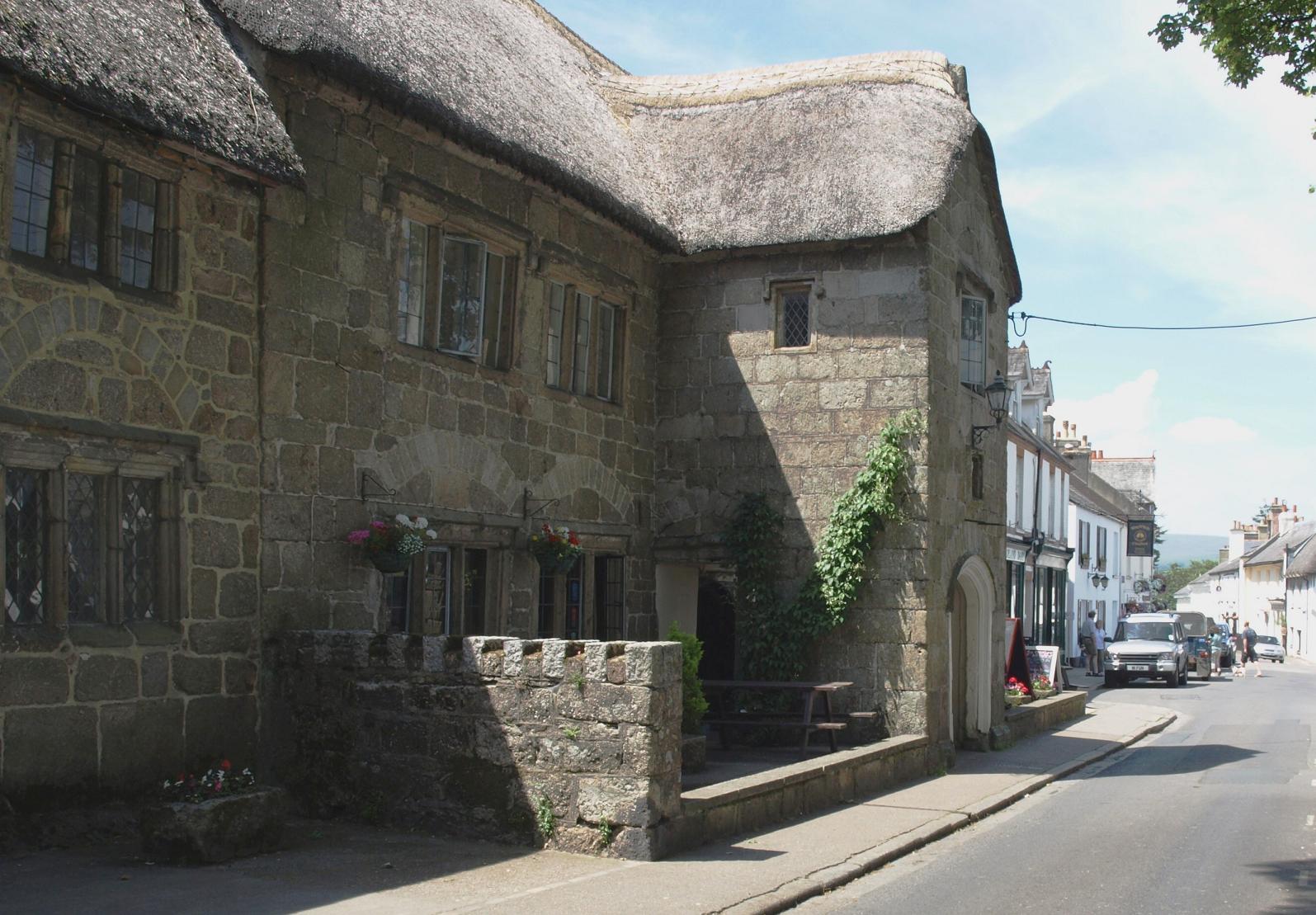 The Three Crowns hotel, Chagford (July 2009). Parts of the building supposedly date from the 13th century, but the structure is mostly early 16th century. It was a manor house for a long time before it became an inn. It is said that Sidney Godolphin was killed in the substantial front porch in 1643 by a musket shot during a Civil War skirmish between the Roundheads quartered at Chagford, and a Royalist force en route from Cornwall to Okehampton. It is also claimed that his ghost haunts the hotel, striding the corridors in the Cavalier uniform of the period. Godolphin was quite an important person – he came from a prominent Cornish family, had been a Member of Parliament since the age of 18, and was a valued adviser to Royalist commanders. He was also a scholar and poet of some note.
 Looking towards The Square from North Street, Chagford (March 2013)
 A cottage in Lower Street, Chagford (July 2009)
There are several ancient farmsteads in the Chagford area, some of which are listed in the Domesday Book.
The English Heritage listing for Hole Farmhouse describes it as one of the best-preserved examples of the Dartmoor longhouse type, being ‘remarkably complete, at least from circa 1668 when the house completed its development from late medieval origins’.
 Hole Farm (August 2013)
and part of the wall of a nearby barn beautifully built from granite rubble 
Yardworthy is another long-established farmstead.
 Yardworthy farmhouse (August 2013)
The Mariner’s Way trackway (described in the Bovey Valley page) passes through the farmyard of Yardworthy.
 and here it is a little way south of the farm, set down out of the wind between banks reinforced with granite boulders, and with an old granite gatepost on the left. (August 2013)
The two branches of the Teign come together near Leigh Bridge, about 6 miles from the source.
 Leigh Bridge (February 2011)
 The Teign from Leigh Bridge (February 2011)
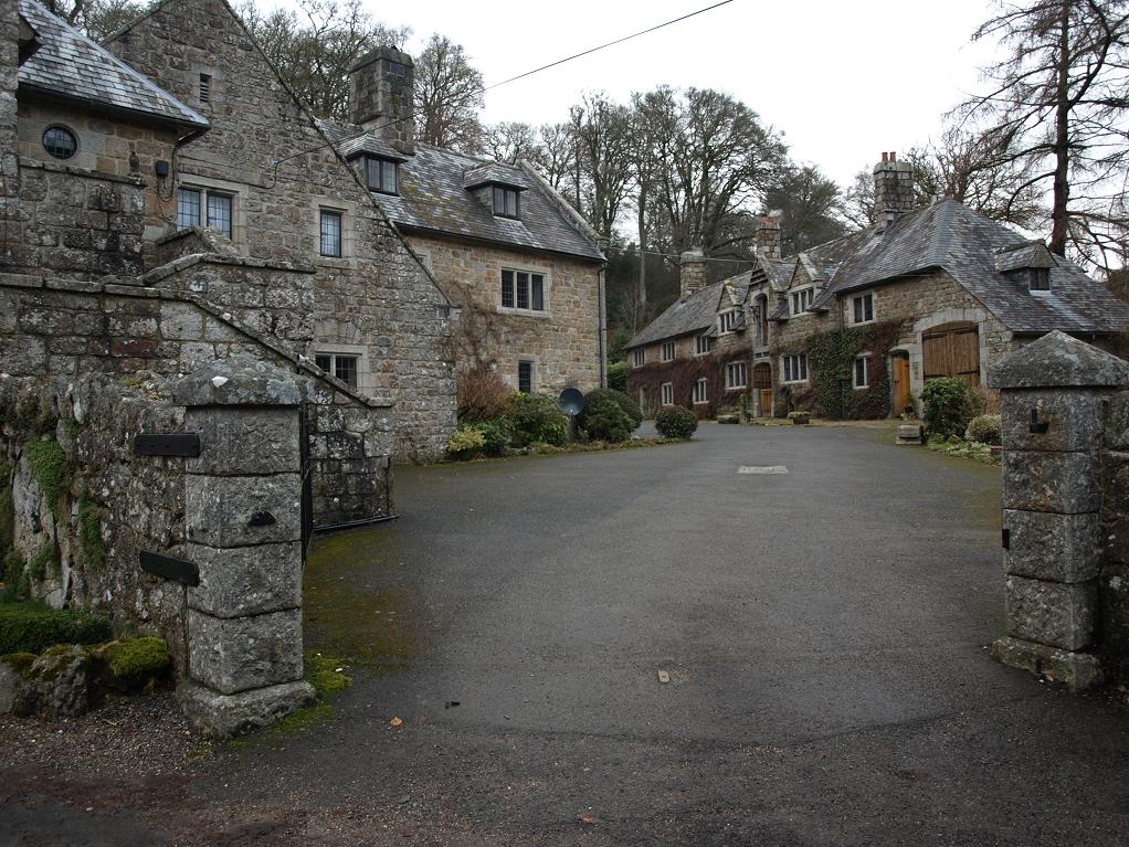
Holystreet Manor (February 2011)
Not far from Leigh Bridge, on the minor road from Chagford to Gidleigh Park, this was originally a 16th or early 17th century mansion. In 1913 it was bought in a dilapidated state by Mary Ellis, a member of the (then and now) extremely wealthy Howard de Walden family. Improbably, Ellis had made a name as a racing motorcyclist, and she came to Devon to hunt wild animals with dogs, which I suppose is what some rich people like to do in the countryside, both then and now. She employed the Surrey architect Turner Powell, an expert on Tudor houses, to renovate the house and its many outbuildings. The interior of the house features granite stone arches and lead paned windows with little ornamentation, in a style somewhat similar to Castle Drogo. The grounds are enclosed within a loop of the Teign. The house has an unusual method of heating, involving extracting heat from the river water through a kilometre of narrow metal pipes, working on the opposite principle to a refrigerator.
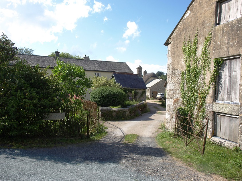
Murchington is a small settlement, situated on a minor road between Gidleigh and Chagford. It has a fine cluster of old farm buildings.
 The road through Murchington (July 2013). The building on the right is part of Mount Pleasant Farm.
The Blackaton Brook rises on the moor between Cosdon Hill and Kennon Hill and joins the Teign just downstream of Gidleigh Park. Together with its small tributary streams, it drains the area north west of Chagford almost as far north as the A30 trunk road.
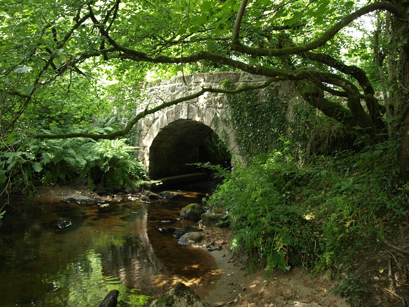 The Blackaton Brook at Highbury Bridge, between Gidleigh and Murchington (July 2013)
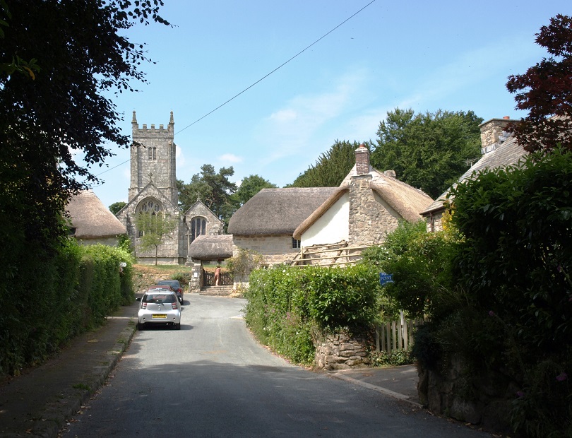
Gidleigh is a small village north of Gidleigh Park, now the site of an up-market hotel and restaurant. The North Teign flows through the woods of Gidleigh Park soon after it leaves the moor. The village is centred on its beautiful granite church, dedicated to The Holy Trinity.
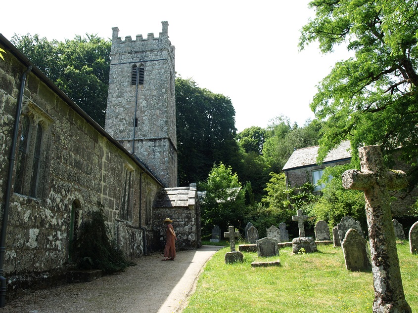 Gidleigh church (July 2013)
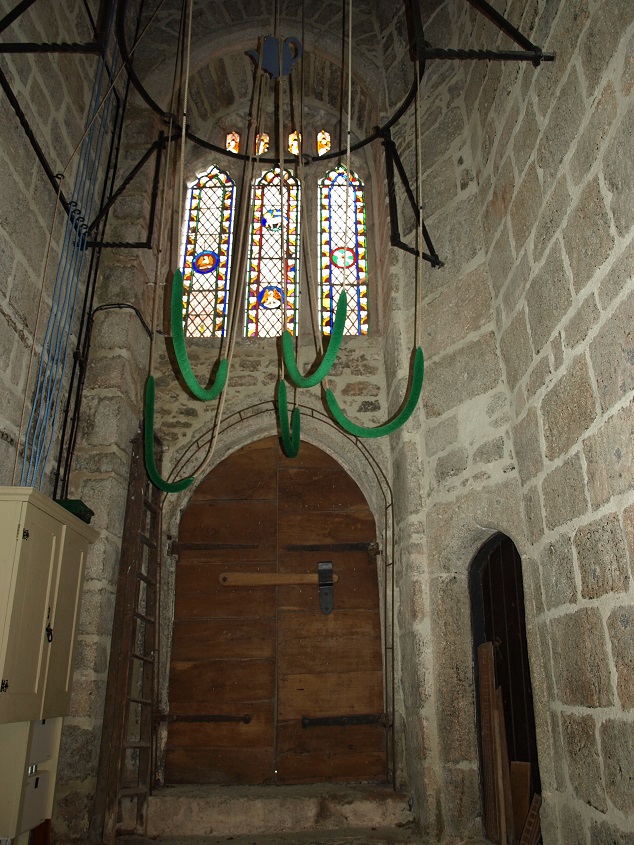 The bell ropes at the base of the tower, Gidleigh church (July 2013)
Historians speculate that ‘Gidleigh’ was derived from its recorded 12th century name Geddelagæ, which can be interpreted as ‘Gydda’s Clearing’, and they link ‘Gydda’ with Gytha Torkelsdotter, the wife of Earl Godwine of Wessex, a very important person in pre-Conquest England. One of their children was Harold, who became King and was defeated by William of Normandy’s forces in 1066. While it is generally accepted that Gytha was in Exeter in 1068, where she assisted in organising the defence of the city, and escaped after its surrender to the Normans, for me this connection seems very unlikely.
The ruins of Gidleigh Castle are right next door to the church, in a private garden. It was never really a castle; it was built around 1324 as a fortified manor house. Only the first two floors of the keep tower remain.
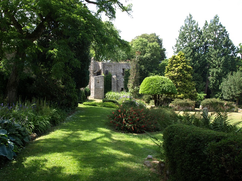 The remains of Gidleigh Castle (July 2013)
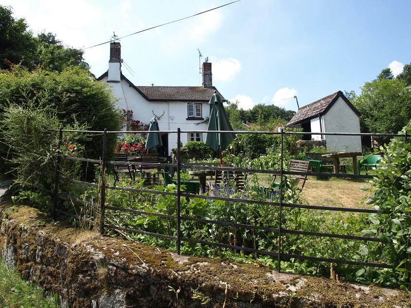
Neither Gidleigh or Throwleigh now has a village pub, but there is one in Wonson, a hamlet between the two, set just above the Forder Brook, a tributary of the Blackaton Brook. The Northmore Arms is a small old fashioned country pub, with an open fire and beer dispensed from wooden barrels.
 The garden of the Northmore Arms (July 2013)
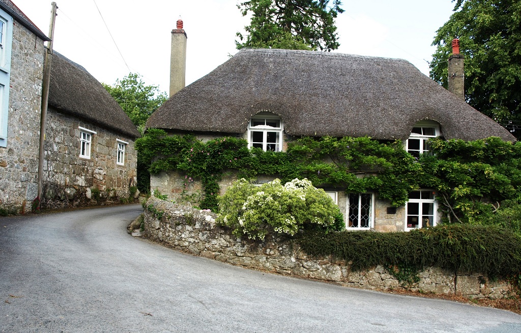
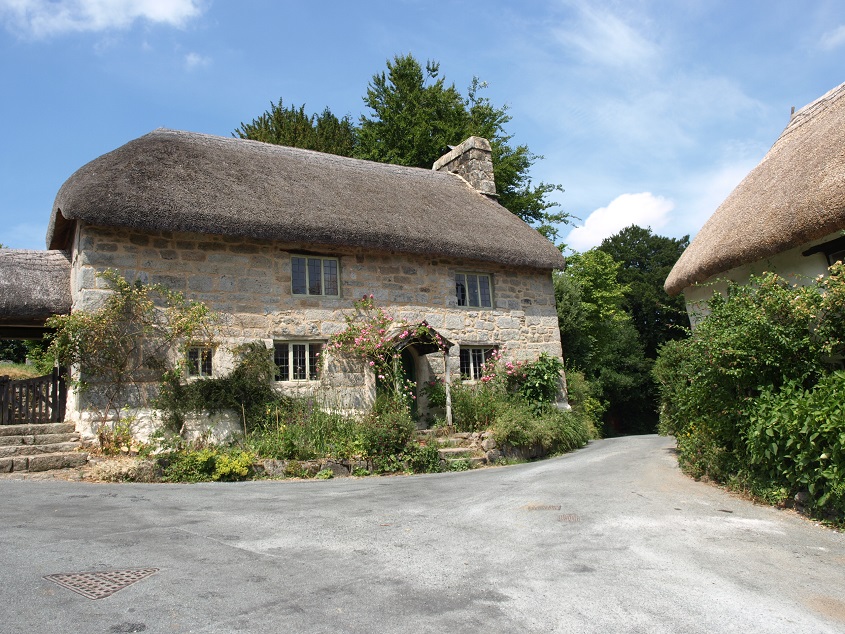
Throwleigh is a small village about a mile and a half north of Gidleigh, set in a network of small lanes. The centre has several cottages dating from the 16th and 17th centuries.
 This is the 16th century Church House, just below the churchyard. (July 2013).
The left hand (southern) end of Church House is seen again below, with its unusual granite mullion windows and the attached thatched lych gate.
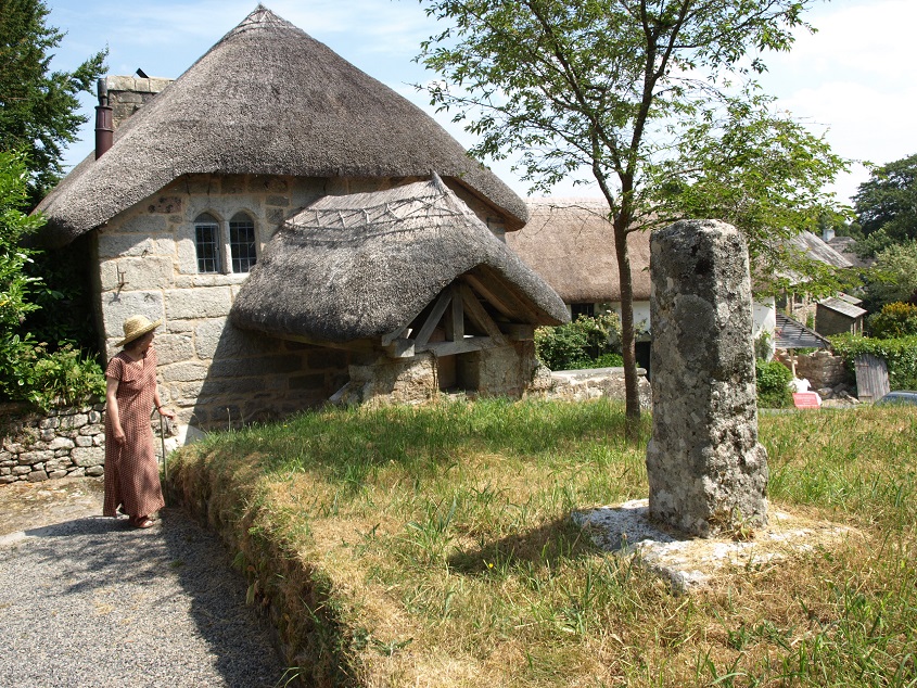 The stone in the foreground is a cross shaft, discovered during renovation work at Throwleigh Barton in 1977.
 Throwleigh church (July 2013). Much of the structure including the impressive tower was built in the mid-15th century. Parts of the churchyard are deliberately left uncut to encourage wildflowers.
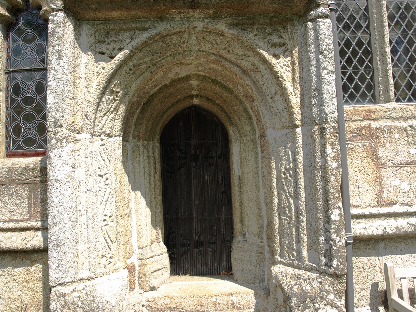 The priest’s doorway, Throwleigh church (July 2013). The door itself is noticeably small and narrow. The inner frame is a two-centred arch with a moulded surround. The outer frame is set forward from the church wall and the surround is carved with stylized ferns and has deeply cut carved foliate spandrels. This door enabled the priest to enter the chancel (the area around the altar) without having to go through the nave – in previous centuries only the priest was allowed in the chancel, which was often separated from the public area by a screen.
 Throwleigh main street (July 2013).
Around Throwleigh and Gidleigh there is evidence of human habitation going back 3,000 years or more- the remains of hut circle villages have been found all along the moorland road and extending up the slopes of Cosdon Hill.
 Looking towards Cosdon Hill from the Dartmoor Way/ Taw-Teign Link footpath near East Week (July 2012)
 … and a nearby disused, overgrown phone box. Nowadays phone boxes that were once an important community facility but have now been abandoned to nature, are often encountered in rural areas.
The road from South Zeal to Whiddon Down more or less marks the northern boundary of the Teign catchment in this area. On the catchment boundary: Livaton Cross, between Whiddon Down and South Zeal (July 2013)
The road through Whiddon Down used to be the A30 trunk road between Exeter and Okehampton. It was by-passed when the new dual-carriageway A30 was opened in the 1980s. Whiddon Down was one of the post points on the turnpike road that formed part of the main Penzance -London route. From the mid 17th the mail was transported by horse riders between ‘posts’ where the postmaster would remove the letters for the local area before handing the remaining letters and any additions to the next rider.
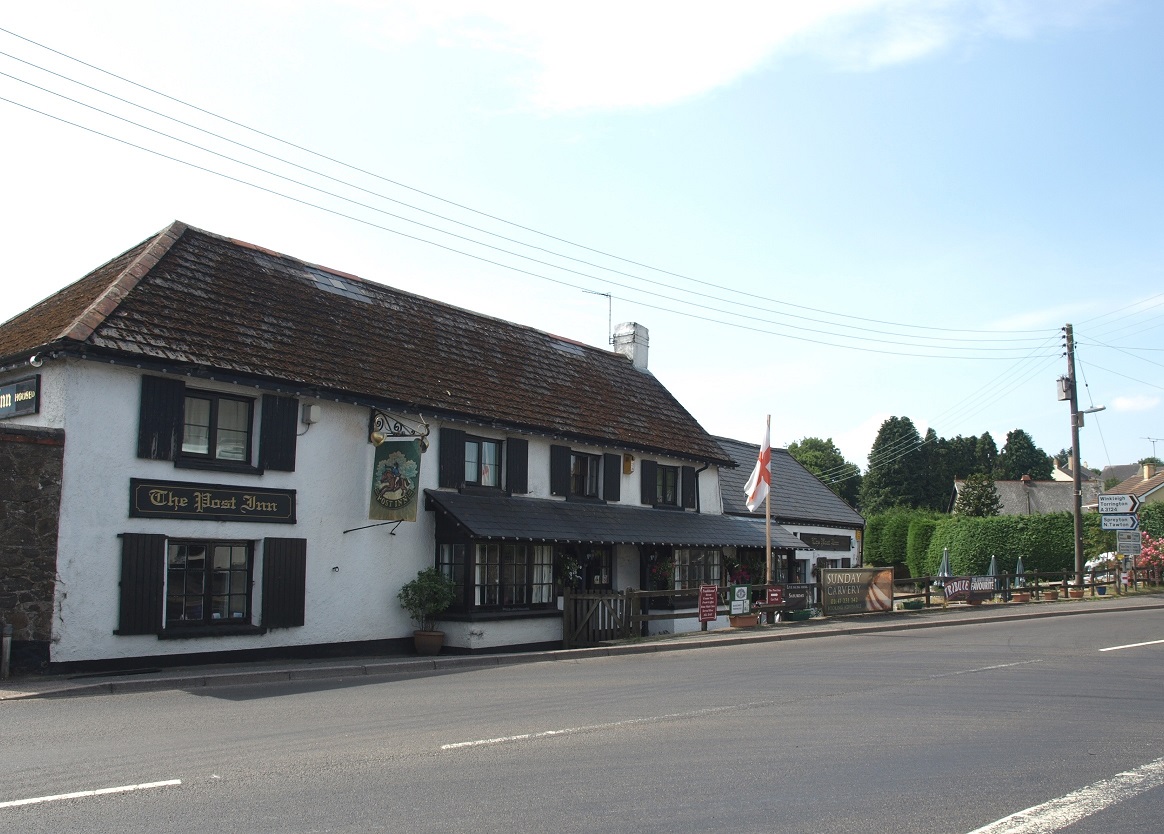 The Post Inn, Whiddon Down. (July 2013) As its name suggests, this was the post point for some time. Its name was changed from the ‘Post Office Inn’ in 1948.
Mail coaches drawn by four horses were introduced in the 1780s and continued in operation until the railways took over from the 1840s. Fresh horses were supplied every 10 to 15 miles. Initially the coaches averaged 7 to 8mph in summer and about 5mph in winter, but by the 1830s the roads had improved enough to allow speeds of up to 10mph. The coaches had armed, uniformed guards, and had room for a four passengers inside and more sitting outside with the driver. They had priority on the roads, so a horn was used to advise other road users of their approach.
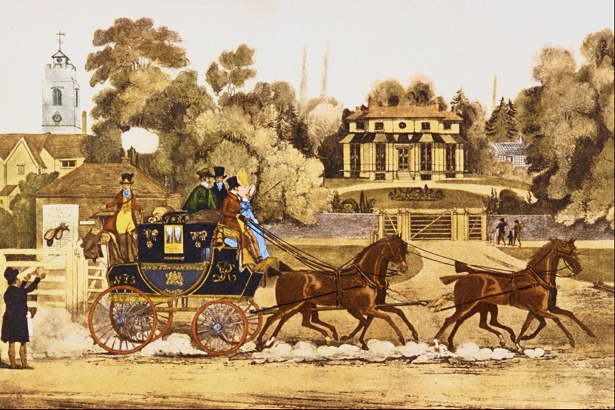 A painting of a Royal Mail coach, showing the guard throwing bags of mail for local delivery to a postal worker.
Spinsters’ Rock, about two miles south east of Whiddon Down, is the remains of a Neolithic chambered tomb, built around 5,000 years ago. Originally the stone structure would have been covered by a mound of earth. Once there would have been burial mounds all over the landscape, and it’s interesting to speculate why the skeleton of this one has survived. It collapsed in 1862 after the field it is in was ploughed after heavy rain. The stones were soon re-erected, but probably not exactly as it was. The Legendary Dartmoor website offers several possible explanations for its name: see http://www.legendarydartmoor.co.uk/spinster.htm.
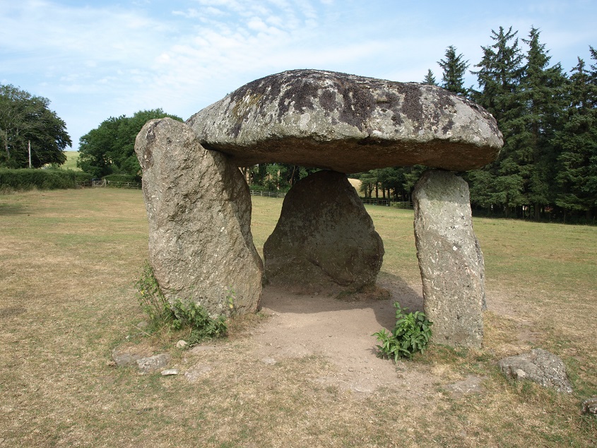 Spinsters’ Rock (July 2013)
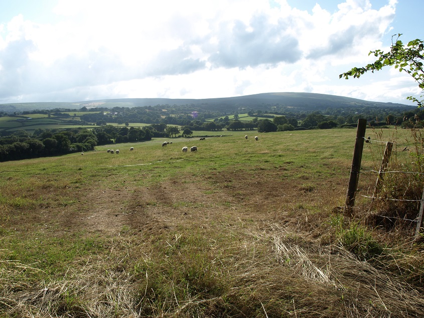
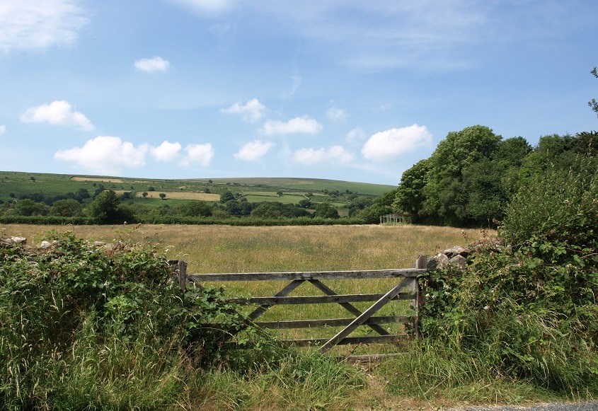
And finally, this is a view of the valley of the Blackaton Brook with Kennon Hill in the distance. It was taken at Waye Farm, just off one of the minor roads between Whiddon Down and Chagford. (August 2013)